Modern planning was born of a public health emergency. The industrial cities of the nineteenth century killed their inhabitants, and the response was to give the state the power to decide where building happens, how much and for what. Everything that followed — Haussmann's boulevards, the garden city, the Athens Charter, the housing estates and the return to the street — are variations on that power and on who wields it.
This guide runs through that history without nostalgia: what real problem each movement was trying to solve, what it achieved, what it destroyed along the way, and which part of it is still in force in your city's plan, often without anyone remembering where it came from.
The problem that started everything: the industrial city
Between 1800 and 1850, Manchester grew from seventy-five thousand to more than three hundred thousand people. Houses were built back to back, with no cross ventilation, no sewers and privies shared by dozens of families. A worker's life expectancy in the worst districts was half that of a property owner in the same city.
Friedrich Engels walked those districts in 1844 and published The Condition of the Working Class in England (1845), the first modern urban study, in which he also observed that the layout of commercial avenues hid the misery from anyone travelling from the centre to the villas. Edwin Chadwick, from the opposite political corner, reached similar sanitary conclusions, and his 1842 report drove Britain's public health legislation.
From this comes planning's first tool: the building ordinance. Minimum street width, maximum height as a function of that width, mandatory courtyard, a lavatory per dwelling, connection to the mains. They are modest rules and they saved more lives than almost any later plan. Much of today's regulation descends directly from them.
Haussmann and urban surgery
Between 1853 and 1870, Baron Haussmann remade Paris on Napoleon III's orders: he cut the great boulevards, built the sewer network, brought in water, created parks and set a façade code that gave the city its recognisable look. The operation is the founding model of authoritarian planning: decide from above, expropriate, demolish, rebuild.
The results were real. Paris went from an insanitary, epidemic city to one with modern infrastructure, and its fabric still works a century and a half later. So were the costs: tens of thousands of poor families were displaced from the centre to the periphery without rehousing, and the operation was financed by a land value uplift that enriched owners and speculators close to power.
David Harvey analysed it in Paris, Capital of Modernity (2003) as the canonical example of what he calls the spatial fix: investment in the built environment as a way of absorbing surplus capital. The model was exported to Barcelona, Vienna, Brussels, Buenos Aires and Mexico City, and its influence reaches the renewal schemes of the twentieth century.
The utopias: garden city, industrial city, radiant city
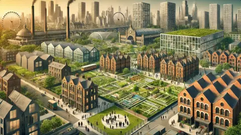
Ebenezer Howard published the garden city in 1898: settlements of around thirty thousand people ringed by an agricultural green belt, with their own industry, houses with gardens and — the point almost always forgotten — land owned by the community, so that rising values would fund the services. Letchworth and Welwyn were built; the idea was copied worldwide keeping the garden and discarding common ownership, which was the innovative part.
Le Corbusier proposed the opposite out of the same dissatisfaction: if congestion is the problem, separate the uses and build upwards to free the ground. The Ville Radieuse and the 1933 Athens Charter set out the functionalist programme, with its four separated functions — dwelling, working, recreation and circulation — and its explicit contempt for the corridor street.
That programme, more than any other doctrine, defines the city built in Europe and America between 1945 and 1975: open blocks surrounded by free space, strict separation of uses, road hierarchy and the car at the centre of the scheme. It was built fast, it housed millions of people coming out of slums, and a considerable part of it aged badly, less because of its form than because maintenance was abandoned and poverty concentrated.
1961: the year the street fought back
Jane Jacobs published The Death and Life of Great American Cities in 1961, the book that broke the consensus. Her argument was not aesthetic but empirical: the neighbourhoods planners considered chaotic and condemned to demolition worked better than the ones built to replace them. Her explanation is eyes on the street, the natural surveillance produced by mixed uses, short blocks, buildings of varied age and sufficient density.
Jacobs was not an academic, and that was part of her force: she wrote from direct observation of Hudson Street and from the fight against Robert Moses's plans to drive an expressway through the Village. Robert Caro told the other half of that story in The Power Broker (1974), the anatomy of unelected power that remade New York.
Criticism arrived from several directions at once. Christopher Alexander showed in 1965 that a city is not a tree — that the clean hierarchies planners draw do not correspond to how a city is actually used. Kevin Lynch had shown in 1960 that people navigate the city with mental maps made of paths, edges, districts, nodes and landmarks. And Jan Gehl began systematically measuring what people do in public space, rather than what they ought to do.
From plan to process: participation, critique and the market
The 1960s and 1970s questioned who plans. Sherry Arnstein published her ladder of participation in 1969, distinguishing between informing, consulting and genuinely ceding power. Paul Davidoff proposed advocacy planning, in which the professional works for the affected community rather than the administration. John Turner argued, from Peru's barriadas, that people build their own housing better than the state does if given land, legal security and services.
At the same time, Marxist criticism changed the question. Henri Lefebvre published The Right to the City (1968) and argued that space is not a neutral stage but a social product. Manuel Castells questioned in The Urban Question (1972) whether the urban exists as an object at all, and David Harvey showed in Social Justice and the City (1973) that location silently redistributes real income.
The political response of the 1980s went the other way: less plan, more market. The emblematic operations — London's Docklands, Baltimore's harbour, Olympic Barcelona — were done through joint ventures, public land and large image projects. This is the entrepreneurial city David Harvey described in 1989, which produced spectacular regeneration and equally notable displacement.
What has accumulated since
New urbanism, from 1993, reclaimed the street, the block and mixed use as a programme, with Peter Calthorpe formulating transit-oriented development and Andrés Duany and Elizabeth Plater-Zyberk writing form-based codes. The sharpest criticism of it is that many of its developments are expensive suburbs dressed as villages, without the social diversity they claimed to seek.
Tactical urbanism inverted the scale: cheap reversible interventions — paint, planters, bollards and chairs — to test a change before spending on construction. It works very well as a test and very badly as a permanent substitute for investment.
And the axis organising almost everything else today is climate: Carlos Moreno's fifteen-minute city, Salvador Rueda's superblocks, sustainable drainage, green infrastructure and the energy retrofit of the existing stock. It is telling that, a century and a half later, the argument is again the one from 1845: the form of the city determines the health of those who live in it.
What survives of each movement in your city's plan
Almost all of it is still there, layered. From the sanitary ordinance come heights, courtyards, ventilation and separation distances. From Haussmann, compulsory purchase for public benefit and the great road-cutting operations. From the garden city, the green belt, the British new towns and, misunderstood, the estate of detached houses. From functionalism, use zoning, road hierarchy and the standards of facilities per inhabitant.
From Jacobs and her contemporaries come the protection of existing fabric, mixed use and distrust of demolition. From the 1960s, public consultation stages and participatory processes. From the 1980s, planning agreements and public-private companies. And from the last decade, energy efficiency ordinances and climate adaptation plans.
The use of knowing this history is practical: when a rule seems absurd, it almost always solves a real problem from another era. Knowing what that problem was lets you judge whether it still exists — and that is exactly the point at which James Scott warned of the opposite: that the greatest damage is done not by old rules, but by the certainty that this time we really do know how people should live.
Frequently asked questions
- When was modern planning born?
- In the mid-nineteenth century, as a sanitary response to the industrial city. The 1842 Chadwick report in Britain and Engels's 1845 book on Manchester documented mortality in working-class districts and gave rise to the first urban hygiene ordinances.
- What was the Athens Charter?
- The 1933 functionalist document driven by Le Corbusier that set out the strict separation of four urban functions: dwelling, working, recreation and circulation. It defined Western planning between 1945 and 1975 and is the origin of use zoning.
- Why does Jane Jacobs matter so much?
- Because in 1961, by observing her own street, she showed that the neighbourhoods planners wanted to demolish worked better than their replacements. Her concept of eyes on the street explains safety through the presence of people rather than policing.
- What did the garden city actually propose?
- Settlements of around thirty thousand people with a green belt, their own industry and, above all, community ownership of the land so that rising values would fund the services. That last and most innovative part is the one almost never copied.
- Is functionalist planning still in force?
- Largely yes, though nobody defends it any more. The use zoning, street hierarchy and standards of facilities per inhabitant used by master plans come directly from it, and still determine what is legal to build.